

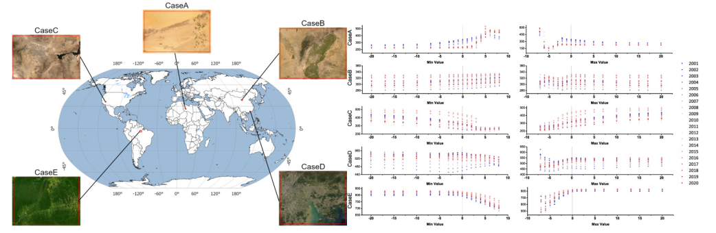
"Compared to the extensive applied research, work on the instability assessment and improvement of RSEI is particularly scarce and urgently needed. Therefore, in this paper, we analyzed the possible instabilities in the RSEI calculation process and proposed various inversion models to evaluate their accuracy and stability in time-series LSES monitoring."
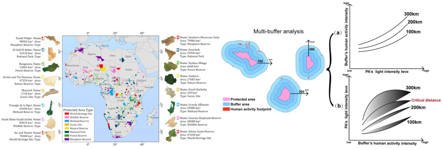
"Previous studies have focused on light pollution in PAs and evaluated light radiation using nighttime light imagery. However, given the scale and span of these studies (national scale and over short periods), PA light pollution research should be advanced further. In this paper, we conducted long-term (1992–2018) monitoring and evaluation of light pollution in African PAs using aligned multi-sensor NTL data."


created with
Best Free Website Builder .